


FREMONT 111 Voting District, Lake County, Illinois
About
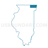
Outline

Summary
| Unique Area Identifier | 572020 |
| Name | FREMONT 111 Voting District |
| County | Lake County |
| State | Illinois |
| Area (square miles) | 1.26 |
| Land Area (square miles) | 1.03 |
| Water Area (square miles) | 0.23 |
| % of Land Area | 82.00 |
| % of Water Area | 18.00 |
| Latitude of the Internal Point | 42.24773270 |
| Longtitude of the Internal Point | -88.01833230 |
Maps


Graphs
Select a template below for downloading or customizing gragh for FREMONT 111 Voting District, Lake County, Illinois


Neighbors
Neighoring Voting District (by Name) Neighboring Voting District on the Map
- ELA 79 Voting District, Lake County, IL
- ELA 81 Voting District, Lake County, IL
- FREMONT 110 Voting District, Lake County, IL
- FREMONT 112 Voting District, Lake County, IL
- FREMONT 113 Voting District, Lake County, IL
- LIBERTYVILLE 189 Voting District, Lake County, IL
- VERNON 262 Voting District, Lake County, IL
Top 10 Neighboring County Subdivision (by Population) Neighboring County Subdivision on the Map
- Vernon township, Lake County, IL (67,095)
- Libertyville township, Lake County, IL (53,139)
- Ela township, Lake County, IL (42,654)
- Fremont township, Lake County, IL (32,337)
Top 10 Neighboring Place (by Population) Neighboring Place on the Map
Top 10 Neighboring Elementary School District (by Population) Neighboring Elementary School District on the Map
- Fremont School District 79, IL (19,330)
- Mundelein Elementary School District 75, IL (15,091)
- Diamond Lake School District 76, IL (9,187)
Top 10 Neighboring Secondary School District (by Population) Neighboring Secondary School District on the Map
- Adlai E. Stevenson High School District 125, IL (61,187)
- Mundelein Consolidated High School District 120, IL (42,836)
Top 10 Neighboring State Legislative District Lower Chamber (by Population) Neighboring State Legislative District Lower Chamber on the Map
Top 10 Neighboring State Legislative District Upper Chamber (by Population) Neighboring State Legislative District Upper Chamber on the Map
Top 10 Neighboring 111th Congressional District (by Population) Neighboring 111th Congressional District on the Map
Top 10 Neighboring Census Tract (by Population) Neighboring Census Tract on the Map
- Census Tract 8644.02, Lake County, IL (7,277)
- Census Tract 8645.11, Lake County, IL (6,564)
- Census Tract 8640.02, Lake County, IL (6,283)
- Census Tract 8641.08, Lake County, IL (5,740)
- Census Tract 8641.07, Lake County, IL (4,901)